WitMotion WTRTK-M10 / M20 / M20D – Full-Constellation, Full-Frequency RTK GNSS Modules (30 s TTFF, Anti-Jamming)
Original price was: $129.00.$64.50Current price is: $64.50.
Description
Overview
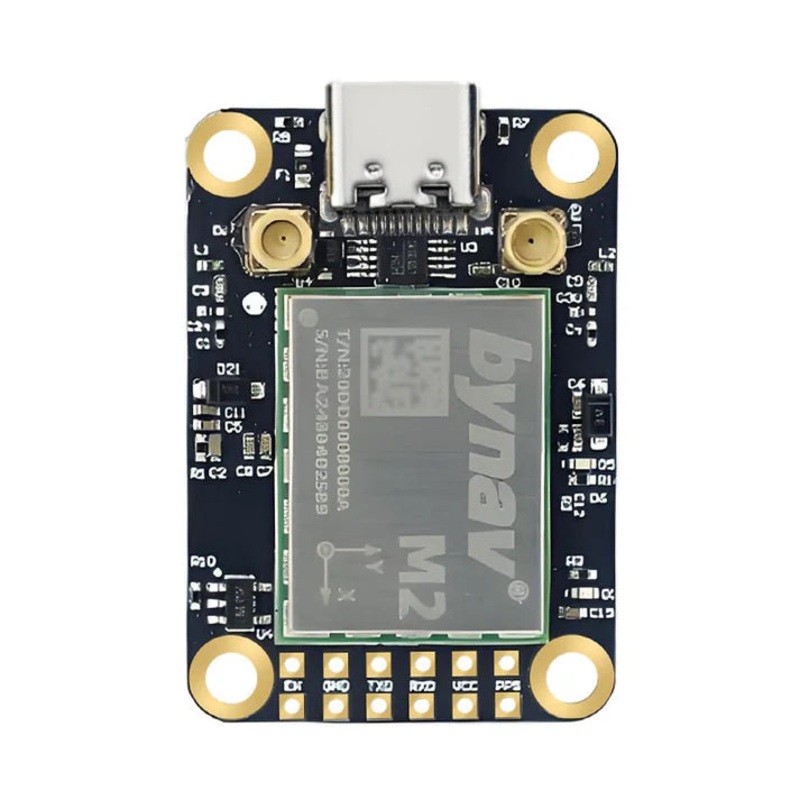
The WitMotion WTRTK-M series are extra-compact RTK GNSS modules built around bynav GNSS SoCs and designed for UAVs, autonomous vehicles, surveying & mapping, and precision agriculture. They provide centimeter-level RTK positioning, PPS time sync, real-time map tracking, satellite signal visualization, and strong anti-interference processing.
TheWTRTK-M10 is an extra-compact, high-precision RTK GNSS positioning module for robotics, UAVs, autonomous vehicles, surveying, and precision agriculture. It integrates a bynav-M10 GNSS SoC with full-constellation, full-frequency reception and advanced anti-interference processing, delivering centimeter-level RTK accuracy and robust heading/position output in complex RF environments. Real-time map tracking, satellite signal views, and diagnostic charts are supported in the WitMotion toolkit.
Model options & key differences
-
WTRTK-M10 bynav-M10, 1500 channels, single-antenna compact rover.
-
WTRTK-M20 bynav-M20, 1507 channels, single-antenna, adds L-Band* and NavIC in the listed signal set.
-
WTRTK-M20D bynav-M20D, 1507 channels, dual-antenna heading/positioning.
All three share the same board size 26 38 7.6 mm, 5 V supply, cold start 30 s, hot start 5 s, baud 115200, RTK accuracy listed below, and anti-jamming processing.
Key Features
-
Full-constellation / full-frequency GNSS with 1500 channels (bynav-M10).
-
Centimeter-level RTK: Horizontal 1 cm + 1 ppm, Vertical 1.5 cm + 1 ppm.
-
Fast TTFF: Cold start 30 s, hot start 5 s.
-
Anti-jamming (SAIF): Adaptive suppression of vehicle anti-tracking, radar and tower interference.
-
Time & speed precision: Time accuracy 20 ns, speed accuracy 0.03 m/s (RMS).
-
PPS output for time synchronization.
-
Compact & light: 26.0 38 7.6 mm board with onboard heatsink area.
-
Software tools: Real-time map tracking, satellite/constellation signal display, VSWR/return-loss antenna diagnostics.
Common performance
-
RTK accuracy: Horizontal 1 cm + 1 ppm, Vertical 1.5 cm + 1 ppm
-
Single-point positioning: Horizontal 1.5 m, Vertical 2.5 m
-
PPS: Pulse-Per-Second output
-
Operating temperature: 40 C ~ +85 C
-
Storage temperature: 40 C ~ +105 C
-
Software tools: Map tracking, satellite signal display, antenna impedance/VSWR diagnostics
-
Applications: Autonomous driving/AGV, drones, surveying, precision agriculture
Signals / channels / antennas
| Model | Channels | Antennas | Listed signal reception* |
|---|---|---|---|
| WTRTK-M10 | 1500 | 1 | BeiDou B1I/B2I/B2a/B3I; GPS L1 C/A, L1C; GLONASS G1/G2; Galileo E1/E5a/E5b |
| WTRTK-M20 | 1507 | 1 | L-Band* / BDS / GPS / GLONASS / Galileo / QZSS / NavIC / SBAS* |
| WTRTK-M20D | 1507 | 2 | BDS / GPS / GLO / GAL / QZSS / SBAS* |
*Exactly as shown on the images; asterisks appear in the originals.
Electrical / timing
| Model | Supply | Typical GNSS power | Cold start | Hot start | Baud |
|---|---|---|---|---|---|
| WTRTK-M10 | 5 V | (not shown on the M10 card) | 30 s | 5 s | 115200 |
| WTRTK-M20 | 5 V | 220 mA @ 5 V | 30 s | 5 s | 115200 |
| WTRTK-M20D | 5 V | 220 mA @ 5 V | 30 s | 5 s | 115200 |
Pinout & Wiring (two 6-pin headers)
| Pin | Name | Function |
|---|---|---|
| 1 | PPS | Pulse-Per-Second |
| 2 | VCC | 5 V power input |
| 3 | RX2 | Serial Port 2 Data Input |
| 4 | TX2 | Serial Port 2 Data Output |
| 5 | GND | Ground |
| 6 | EN | High-level enable |
| 7 | PPS | Pulse-Per-Second |
| 8 | VCC | 5 V power input |
| 9 | RXD | Serial Data Input |
| 10 | TXD | Serial Data Output |
| 11 | GND | Ground |
| 12 | EN | High-level enable |
Board dimensions called out on drawing: 36.58 mm overall height (30.86 mm module area), 25.66 mm top width (20.07 mm inner), pad spacing 5.73 mm / 14.2 mm (as labeled).
Typical Applications
-
Autonomous driving / AGVs
-
Drones (UAV/UAS)
-
Surveying & mapping
-
Precision agriculture
RTK Principle (module workflow)
Base station generates differential data transmits via radio/data network rover (this module) applies corrections for real-time centimeter-level positioning.
Packing list
-
WTRTK-M10 / M20 / M20D module (per selection)
-
Pin headers
-
Heatsink
-
Feeder cable (U.FL to bulkhead feed-through, as shown)
Model Family (for selection)
-
WTRTK-M10 bynav-M10, 1500 ch, single-antenna (this page)
-
WTRTK-M20 bynav-M20, 1507 ch, single-antenna
-
WTRTK-M20D bynav-M20D, 1500 ch, dual-antenna heading
Details
WitMotion WTRTK-M10/M20/M20D GNSS modules feature bynav chips, supporting multiple satellite systems. They offer high positioning accuracy, fast time-to-first-fix, and operate within wide temperature ranges, with compact dimensions and 5V power supply.
RTK Principle: Real-Time Kinematic positioning uses a fixed ground station to calculate GPS errors and transmit corrections via GPRS to a rover, enabling centimeter-level accuracy. Base station generates, transmits differential data; rover uses it for precise real-time positioning.
All-satellite all-frequency high-precision positioning and heading module. Enables centimeter-level accuracy in autonomous driving, drones, surveying, and precision agriculture with real-time data output.
Centimeter-level RTK positioning offers 1 cm accuracy. Supports full-system, full-frequency multi-GNSS. Features strong satellite acquisition, anti-interference, and real-time map tracking with detailed position display.
Signal display monitors satellite frequency and positioning status for accurate navigation. Antenna impedance performance includes VSWR, return loss, and Smith chart analysis via network analyzer.
WitMotion WTRTK-M10/M20/M20D for autonomous driving, drones, surveying, precision agriculture.
WitMotion WTRTK-M10/M20/M20D module features USB interface, 12-pin layout, power, serial communication, PPS, and enable functions for GPS applications.
WitMotion WTRTK-M10/M20/M20D includes mainboards, pin headers, heat sinks, and feeder cables for each model.
Related products
-
Sale!

Garmin DriveSmart 66 6″ Car GPS Navigator (010-02469-00)
Original price was: $187.00.$93.50Current price is: $93.50. Add to cart -
Sale!
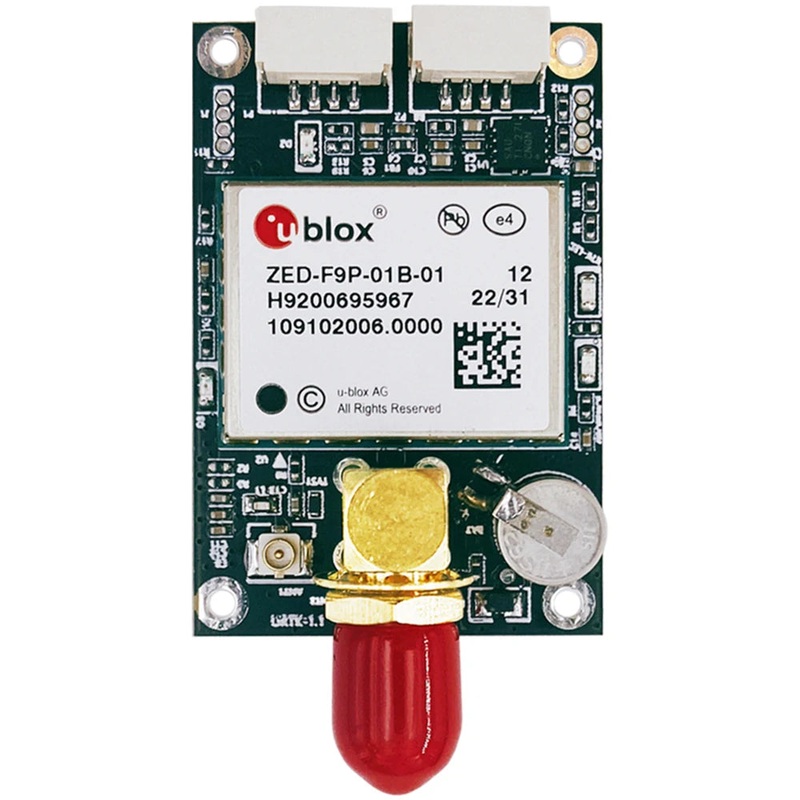
ZED-F9P-01B-01 RTK GNSS/GPS Receiver Board, High Precision Multi-Band Module with USB-C and SMA
Original price was: $198.34.$99.17Current price is: $99.17. Add to cart -
Sale!
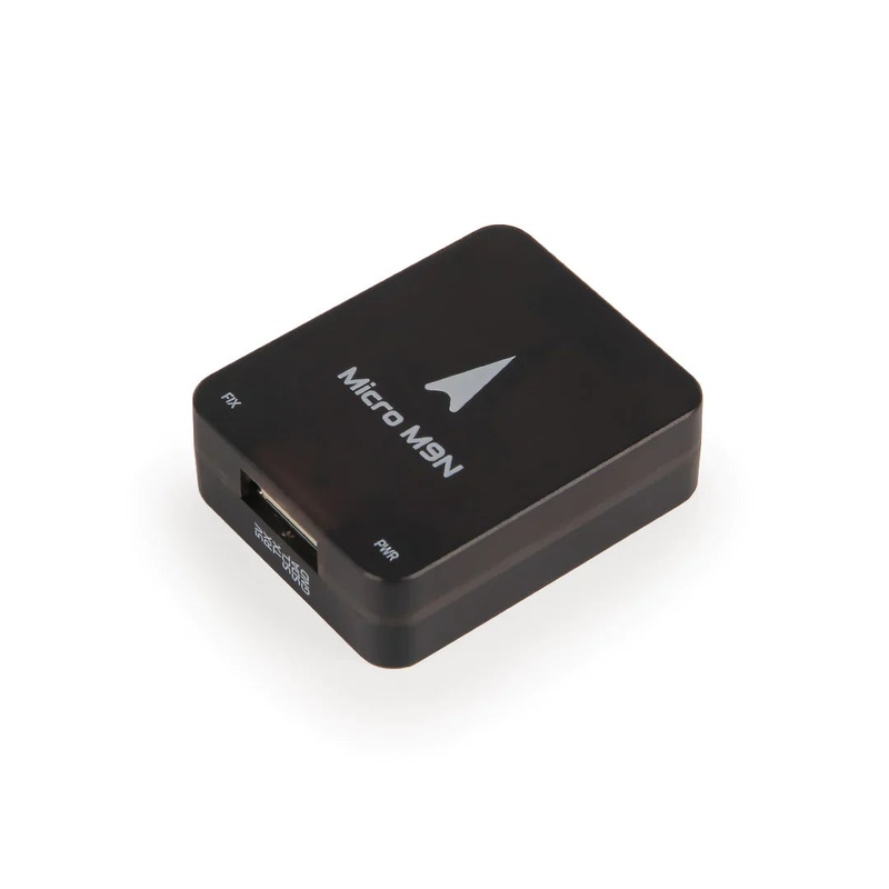
Holybro Micro M9N GPS Module
Original price was: $73.00.$36.50Current price is: $36.50. Add to cart -
Sale!
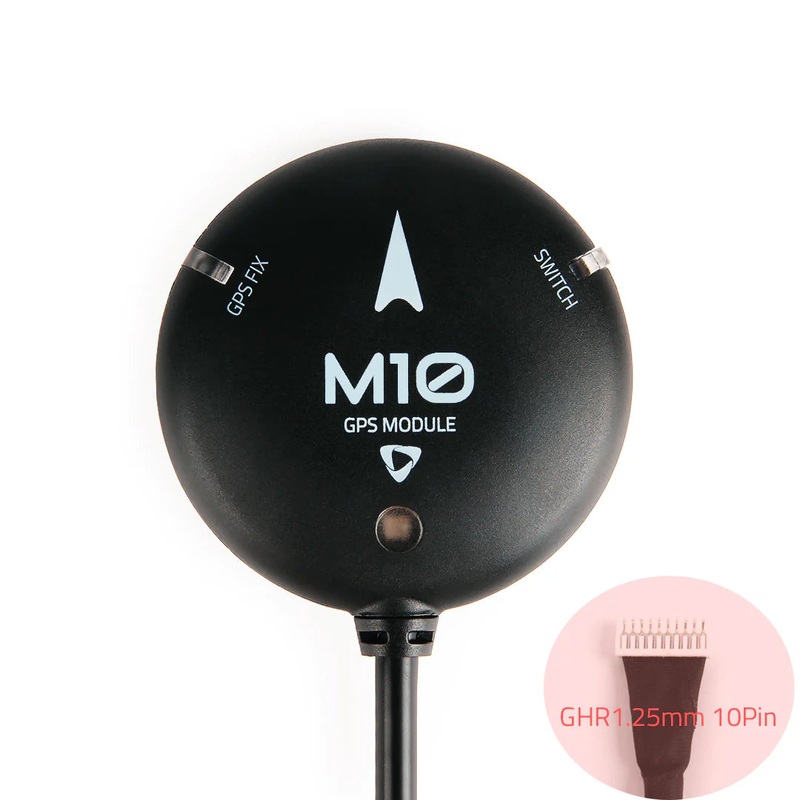
Holybro M10 GPS Module
Original price was: $65.00.$32.50Current price is: $32.50. Add to cart

Reviews
There are no reviews yet.